Map details Evaluate precision Bad Ok Good
Map details Evaluate precision Bad Ok Good
Map details Evaluate precision Bad Ok Good
Map details Evaluate precision Bad Ok Good
Map details Evaluate precision Bad Ok Good
Map details Evaluate precision Bad Ok Good
Map details Evaluate precision Bad Ok Good
1243-1257 University rue
Building year: 1
City: Montréal
Histograd local id: 1172069
Creation date: 2020-04-28 13:25:05 Modification date: 2024-11-05
Les rues disparues avec la construction du Complexe Desjardins
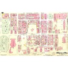
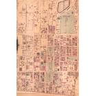
Comme il est possible de voir sur la carte ancienne de 1912, plusieurs petites rues ont littéralement disparues avec la construction du Complexe Desjardins: La rue Benoit, Vallée, De Vienne et St-Georges.
Sunday School of St. George Church
Cette école fut démolie pour laisser place à la construction de l'Hôtel Laurentien, lui aussi maintenant disparu
La Baie 587 rue Sainte-Catherine O
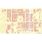
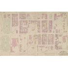
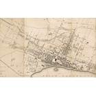
I can assure you that the 1912 map is really from 1912, it looks very similar to the older one but if you see the complete map you can see that it comes from the 1912 series. On the the maps from 1912 you can clearly see the Goodwinds Limited store, not visible on the 1890 map where the Queens Hall stand at the same place.
This page have been seen 1185 times.
Historical score:2019
Localisation: Montréal, MTL, YUL, Québec, Canada
* We do our best to get the best accuracy, but in some maps it's hard to go beyond 20m.
Name this place
Add keywords
Add to a list
To find former residents of this place, visit the directory Lovell
Person or institution related
This place has an historical interest?
Historic Ressources
To find out who lived in this house in the last century search in this historic street index.
Lovell Street Index
Discussions
3449 Peel Street was a student Residence run by the Christian Fellowship Association in the 1940's and 50's. I was there from 1947 to 1950.
Cette maison a été construite en 1960 et était la propriété de monsieur Louis Leclerc
Est-ce que Francine Truchon ou sa sœur Monique habite au 2148, rue Dézéry, à Montréal ? Faites-moi savoir à jorgejuansanchez@yahoo.es Merci!

Add a comment or ask a question