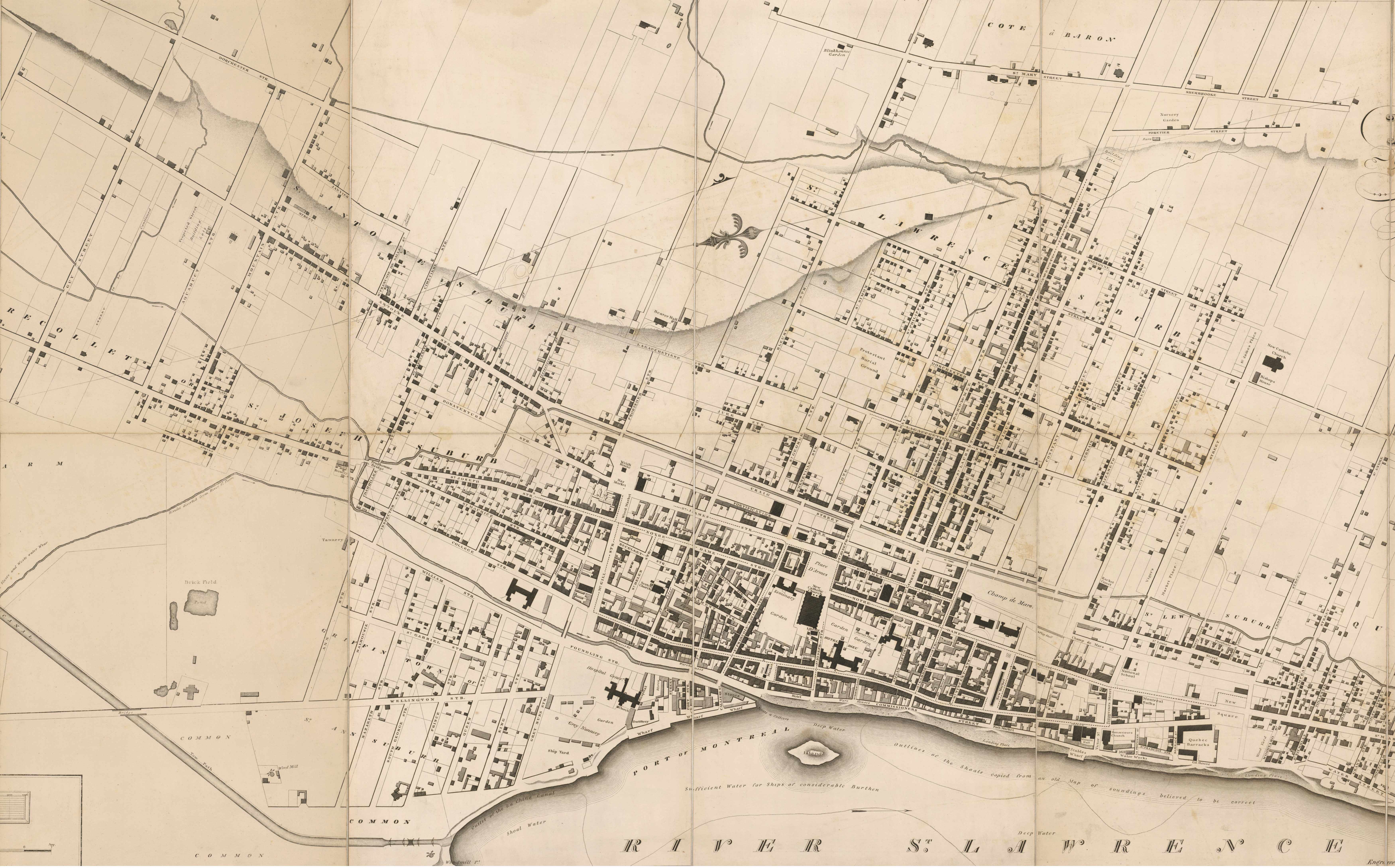
Map - Map of the city and suburbs of Montreal Year: 1825 Streets of Montréal Random discovery ! 📌
Click on the map to zoom more ⚲ Explore other maps of the same location but different year
magnifying glass - size
BANQ / Ville de Montréal - Source
Map added by anonnyous user
ID source: 0005245760
ID local: 375
Number of object linked with that map : 3364
Year of the map: 1825
Legend , 1, 1, 1, 1, 1, 1, 1, 1, 1
Source Title: BANQ
Map's keywords: sud-ouest imperial street
Add keywords
(Help us to describe the content of this map by writing the names of streets or other inscriptions on the map)
Map limits
See the limits of all the maps of the same year
( Réserver aux membres)
Add a comment or ask a question