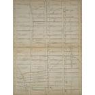
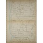
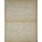
Carte - Farms in Lincoln Sqaure / Upper East Side in 1815  Année: 1815   Rues de New York City Découverte aléatoire!   📌

Ajouté par Alexis77  

Cliquez sur la carte pour augmenter le zoom   Explorer d'autre carte de la même localisation

Loupe - Grandeur


BANQ / Ville de Montréal - Source

Map added by Carte ajoutée par Alexis77

ID source: 1531813

ID local: 455

Nombre d'objets liés avec cette carte: 2135

Année de la carte: 1815
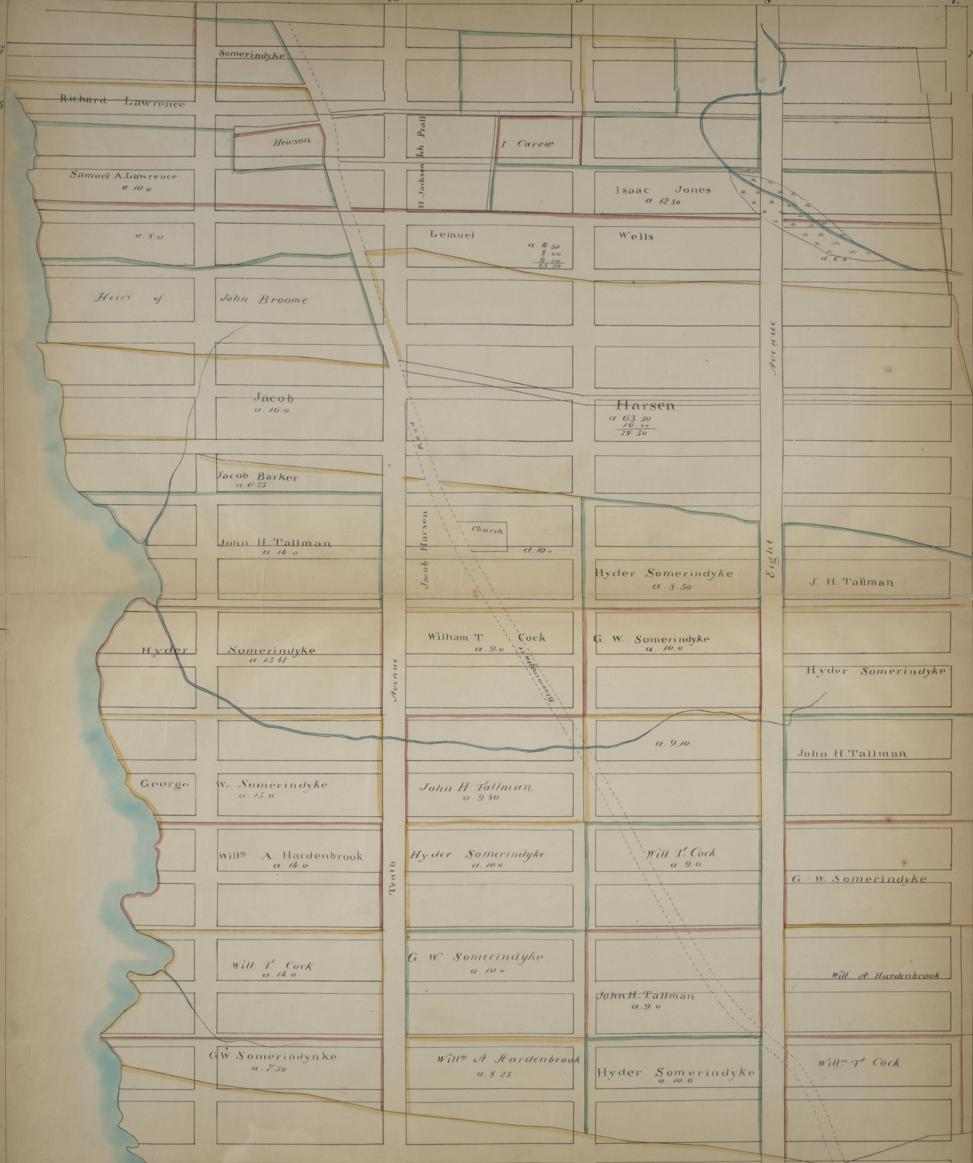
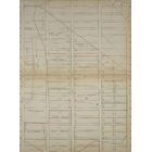
Légende Page 9: [Bounded by W. 77th Street, (Central Park) Seventh Avenue (Lincoln Square), W. 57th Street and Hudson River.], 1, 1, 1, 1, 1, 1, 1, 1, 1

Titre à la source: NYPL

Mots clés de la carte: 61st Thent Avenue


Sofia Condominiums

West Side YMCA

170 Amsterdam

Good Shepherd-Faith Presbyterian Church

The Collegiate School

Three Lincoln Center Condominiums

The Gainsborough

21 West End

Dakota Apartments

San Remo Apartments

Century Condominiums

Manhattan Skating Rink

57 West 75th Street

625 West 57th Street

The Hermitage

St Pauls Convent

220 Central Park South

160 West 62nd Street

Park Royal Hotel

555 West 57th Street

The Harrison

Dutch Collegiate Church

The Oliver Cromwell

Church of the Blessed Sacrament

The Aurora

Majestic Apartments

Grand View Hotel

Lincoln Square Synagogue

Sherman Square Apartments

304 West 75th Street

The Bancroft

One Columbus Place Tower II [One Columbus Place]

Aire

Nordstrom Tower

2 West 67th Street

301 Freedom Place South

175 West 76th Street

40 West 77th Street

Amsterdam Houses Addition [Amsterdam Houses]

230 Central Park South

The Tower of 15 Central Park West

121 West 72nd Street

South Park Tower

221 West 77th

Riverside Memorial Chapel

One Columbus Place Tower I [One Columbus Place]

The Ansonia

Roosevelt Hospital Staff Residence [Roosevelt Hospital]

200 Amsterdam Avenue

Catholic Apostolic Church (Church for All Nations)

3 Columbus Circle

Hotel Commander

2 LINCOLN SQUARE

7 LINCOLN SQUARE

40 LINCOLN CENTER PLAZA

30 LINCOLN CENTER PLAZA

60 LINCOLN CENTER PLAZA

20 LINCOLN CENTER PLAZA

10 LINCOLN CENTER PLAZA

70 LINCOLN CENTER PLAZA

100 PL FREEDOM

600 58 ST

853 11 AVE

606 58 ST

610 58 ST

221 77 ST

1865 BROADWAY

206 77 ST

210 77 ST

332 77 ST

138 70 ST

302 77 ST

320 77 ST

314 77 ST

215 76 ST

166 75 ST

336 77 ST

142 70 ST

310 77 ST

148 70 ST

187 AVE AMSTERDAM

147 70 ST

144 70 ST

312 77 ST

213 76 ST

181 AVE AMSTERDAM

154 70 ST

16 61 ST

334 77 ST

328 77 ST

318 77 ST

140 70 ST

325 77 ST

190 AVE AMSTERDAM

189 AVE AMSTERDAM

155 70 ST

330 77 ST

322 77 ST

321 77 ST

Ajouter des mots clés

(Aidez nous à décrir le contenu de cette carte en y écrivant les noms de rues ou autres inscrit de la carte)


Ajouter un commentaire, poser une question à tous

Il n'y a pas de commentaire pour le moment


Progrès: 10 km2 exploré
Niveau explorateur 1
90  avant le prochain niveau
1850 - 1855 - 1860 - 1865 - 1870 - 1875 - 1880 - 1885 - 1890 - 1895 - 1900 - 1905 - 1910 - 1915 - 1920 - 1925 - 1930 - 1935 - 1940 - 1945 - 1950 - 1955 - 1960 - 1965 - 1970 - 1975 - 1980 - 1985 - 1990 - 1995 - 2000 - 2005 - 2010 - 2015 - 2020 -