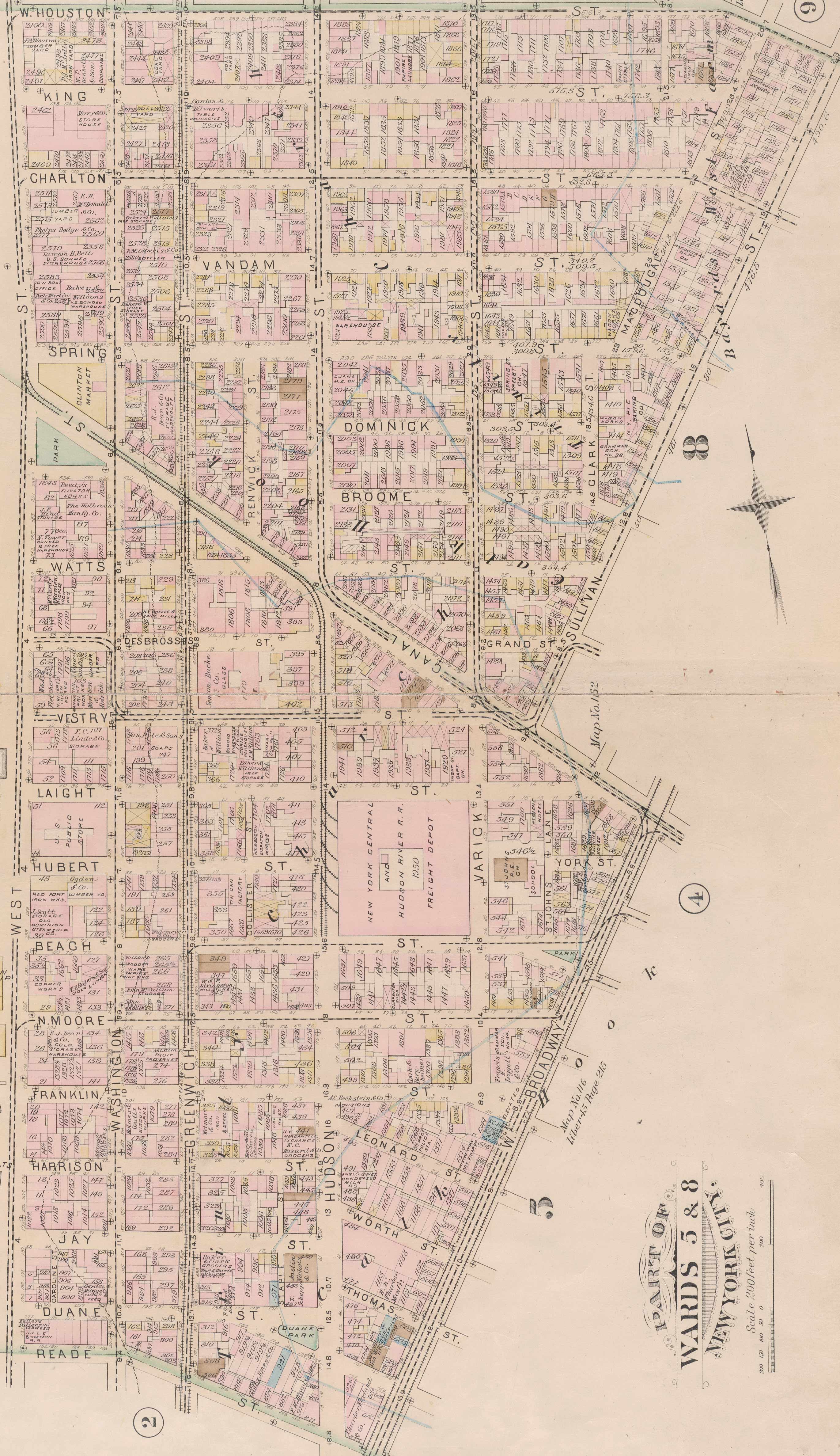
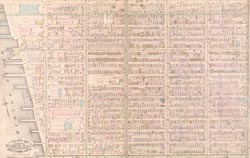
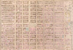
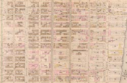
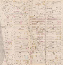
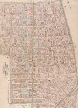
Map - Plate  Year: 1885   Streets of New York City Random discovery !   📌

Click on the map to zoom more   Explore other maps of the same location but different year

magnifying glass - size


BANQ / Ville de Montréal - Source

Map added by anonnyous user

ID source:

ID local: 291

Number of object linked with that map : 1815

Year of the map: 1885

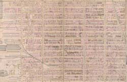
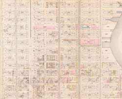
Legend Plate 3: Bounded by West Street (Hudson River, Piers 21-39), W. Houston Street, Sullivan Street, Canal Street, W. Broadway and Reade Street., 1, 1, 1, 1, 1, 1, 1, 1, 1

Map's keywords: REATURANT ON THE CORNER OF HUDSON AD 6TH AVENUE


SoHo Tower

Trump SoHo Hotel Condominium

FIFTY Franklin

100 Vandam Street

Hampton Inn Soho

Hotel Hugo

Holland Plaza Building

RenwickModern

345 Hudson Street

Old New York Mercantile Exchange Building

Haggin Building

30 Thompson Street

83 Sullivan Street House

City of New York Building

350 West Broadway

New York State Insurance Fund Building

Shearson Lehman Plaza

Maltz-Franklin Building

New York Central Hudson River Freight Depot

361 Broadway Building (James White Building)

565 Broome Street

The Dietz Lantern Building

Sheraton Tribeca New York Hotel

71 ST HUDSON

160 ST VARICK

61 ST MOORE

51 ST LEONARD

42 ST KING

50 ST LAIGHT

424 ST GREENWICH

481 ST WASHINGTON

110 ST FRANKLIN

136 ST HOUSTON

110 OF THE AMERICAS

114 OF THE AMERICAS

140 OF THE AMERICAS

67 ST HUDSON

71 ST LAIGHT

19 ST LEONARD

353 ST SPRING

500 ST WASHINGTON

73 ST HUDSON

134 ST DUANE

140 ST DUANE

221 ST SPRING

49 ST LISPENARD

63 ST WOOSTER

18 ST JAY

350 ST CANAL

11 ST MOORE

1 ST MOORE

130 ST DUANE

36 ST WALKER

68 ST VANDAM

330 ST WEST

154 ST SPRING

15 ST WHITE

205 ST PRINCE

173 ST SPRING

510 ST BROOME

19 ST VARICK

224 ST WEST

28 PL ERICSSON

303 ST CANAL

69 ST SULLIVAN

12 ST VANDAM

323 ST CHURCH

325 ST HOUSTON

11 OF THE AMERICAS

132 ST SULLIVAN

74 OF THE AMERICAS

48 ST WALKER

65 ST LISPENARD

107 ST FRANKLIN

206 ST WEST

50 ST VANDAM

336 ST CANAL

310 ST CANAL

334 ST CANAL

195 ST HOUSTON

340 ST WEST

44 ST RENWICK

80 ST CHARLTON

281 ST CHURCH

3 PL FRANKLIN

369 BROADWAY

60 ST THOMPSON

120 ST WARREN

47 OF THE AMERICAS

75 ST SULLIVAN

33 OF THE AMERICAS

7 ST MERCER

73 ST SULLIVAN

12 ST MERCER

5 ST MERCER

11 ST GREENE

391 ST CANAL

90 ST THOMPSON

55 ST SULLIVAN

Add keywords

(Help us to describe the content of this map by writing the names of streets or other inscriptions on the map)


Add a comment or ask a question

There are not comment for this place now.


Progress 360 km2 Explored Keep your score !
Exploration Level 3
40  before next level
1850 - 1855 - 1860 - 1865 - 1870 - 1875 - 1880 - 1885 - 1890 - 1895 - 1900 - 1905 - 1910 - 1915 - 1920 - 1925 - 1930 - 1935 - 1940 - 1945 - 1950 - 1955 - 1960 - 1965 - 1970 - 1975 - 1980 - 1985 - 1990 - 1995 - 2000 - 2005 - 2010 - 2015 - 2020 -