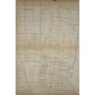
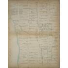
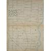
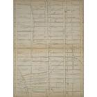
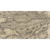
Map - Farms of Manhattan Valley - Morningside in 1815 Year: 1815 Streets of New York City Random discovery ! 📌
Click on the map to zoom more ⚲ Explore other maps of the same location but different year
magnifying glass - size

BANQ / Ville de Montréal - Source
Map added by anonnyous user
ID source: 1531819
ID local: 457
Number of object linked with that map : 2613
Year of the map: 1815
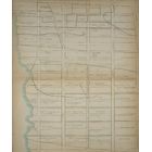
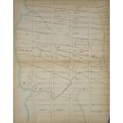
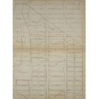
Legend Page 15: [Bounded by W. 115th Street (Morningside Park), Eighth Avenue, (Upper West side), W. 94th Street and Hudson River.], 1, 1, 1, 1, 1, 1, 1, 1, 1, 1, 1, 1, 1, 1, 1, 1, 1, 1, 1, 1, 1, 1, 1, 1, 1, 1, 1, 1, 1, 1, 1, 1, 1, 1, 1, 1, 1, 1, 1, 1, 1, 1, 1, 1, 1, 1, 1, 1, 1, 1, 1, 1, 1, 1, 1, 1, 1, 1, 1, 1, 1, 1, 1, 1, 1, 1, 1, 1, 1, 1, 1, 1, 1, 1, 1, 1, 1, 1, 1, 1, 1, 1, 1, 1, 1, 1, 1, 1, 1, 1, 1, 1, 1, 1, 1, 1, 1, 1, 1, 1, 1, 1, 1, 1, 1, 1, 1, 1, 1, 1, 1, 1, 1, 1, 1, 1, 1, 1, 1, 1, 1, 1, 1, 1, 1, 1, 1, 1, 1, 1, 1, 1, 1, 1, 1, 1, 1, 1, 1, 1, 1, 1, 1, 1, 1, 1, 1, 1, 1, 1, 1, 1, 1, 1, 1, 1, 1, 1, 1, 1, 1, 1, 1, 1, 1, 1, 1, 1, 1, 1, 1, 1, 1, 1, 1, 1, 1, 1, 1, 1, 1, 1, 1, 1, 1, 1, 1, 1, 1, 1, 1, 1, 1, 1
Source Title: NYPL
Map's keywords:
The Cathedral Church of St. John the Divine
First Corinthian Baptist Church
Booker T Washington Middle School
Bloomingdale Branch - New York Free Circulating Library
360 Central Park West, North Building [360 Central Park West]
Towers on the Park Southwest [Towers on the Park]
Saint Gerasimos Greek Orthodox Church
Church of the Holy Name of Jesus
Trinity Lutheran Church of Manhattan
Morris Shapiro Hall [Columbia University]
Broadway United Church of Christ
Little Sisters of the Poor Convent
1864 BLVD ADAM CLAYTON POWELL JR
1844 BLVD ADAM CLAYTON POWELL JR
1838 BLVD ADAM CLAYTON POWELL JR
1902 BLVD ADAM CLAYTON POWELL JR
1858 BLVD ADAM CLAYTON POWELL JR
1854 BLVD ADAM CLAYTON POWELL JR
1842 BLVD ADAM CLAYTON POWELL JR
1840 BLVD ADAM CLAYTON POWELL JR
1878 BLVD ADAM CLAYTON POWELL JR
1800 BLVD ADAM CLAYTON POWELL JR
Add keywords
(Help us to describe the content of this map by writing the names of streets or other inscriptions on the map)
Map limits
See the limits of all the maps of the same year
( Réserver aux membres)
.jpg)
Add a comment or ask a question