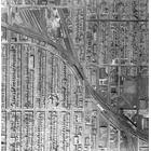
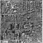
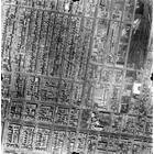
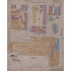
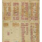
Map - Notre-Dame-de-Grâce Year: 1949 Streets of Montréal Random discovery ! 📌
Click on the map to zoom more ⚲ Explore other maps of the same location but different year
magnifying glass - size

BANQ / Ville de Montréal
Map added by anonnyous user
ID source: 0003343054
ID local: 357
Number of object linked with that map : 0
Year of the map: 1949
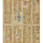
Legend [Plans utilisation du sol de la ville de Montréal, novembre 1949] [document cartographique] / Ville de Montréal,Urbanisme, 1, 1, 1, 1, 1, 1, 1, 1, 1, 1, 1, 1, 1, 1, 1, 1, 1, 1, 1, 1, 1, 1, 1, 1, 1, 1, 1, 1, 1, 1, 1, 1, 1, 1, 1, 1, 1, 1, 1, 1, 1, 1, 1, 1, 1, 1, 1, 1, 1, 1, 1, 1, 1, 1, 1, 1, 1, 1, 1, 1, 1, 1, 1, 1, 1, 1, 1, 1, 1, 1, 1, 1, 1, 1, 1, 1, 1, 1, 1, 1, 1, 1, 1, 1, 1, 1, 1, 1, 1, 1, 1, 1, 1, 1, 1, 1, 1, 1, 1, 1, 1, 1, 1, 1, 1, 1, 1, 1, 1, 1, 1, 1, 1, 1, 1, 1, 1, 1, 1, 1, 1, 1, 1, 1, 1, 1, 1, 1, 1, 1, 1, 1, 1, 1, 1, 1, 1, 1, 1, 1, 1, 1, 1, 1, 1, 1, 1, 1, 1, 1, 1, 1, 1, 1, 1, 1, 1
Source Title: BANQ
Map's keywords: Girouard Monkland Côte-Saint-Antoine Godfrey Park orchard Avenue Coolbrook herbert symonds 2264 old orchard 4632 3492 de vendome 3636 3451 oxford Harvard orphelinat 4169 Grand Blvd ndg 6065 sherbrooke 4524 avenue Draper
Add keywords
(Help us to describe the content of this map by writing the names of streets or other inscriptions on the map)
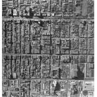
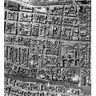
photos duplex
photos duplex
Map limits
See the limits of all the maps of the same year
( Réserver aux membres)
Maps from same year


Add a comment or ask a question