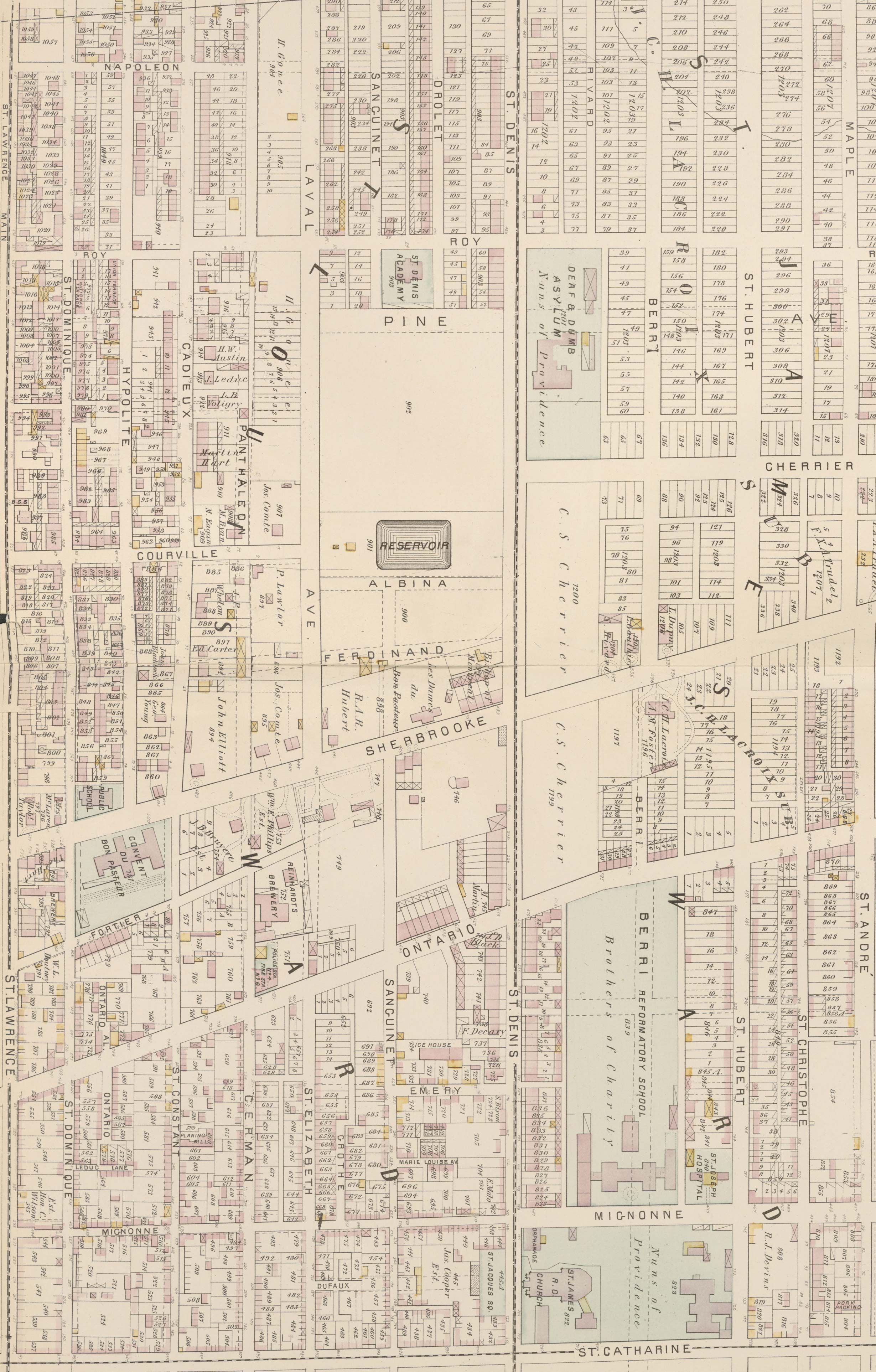
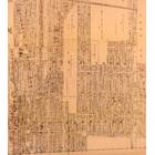
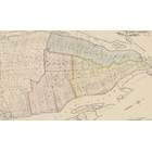
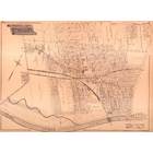
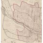
Map - Le Plateau - Quartier Saint-Jean-Baptiste en 1879 Year: 1879 Streets of Montréal Random discovery ! 📌
Click on the map to zoom more ⚲ Explore other maps of the same location but different year
magnifying glass - size
BANQ / Ville de Montréal - Source
Map added by anonnyous user
ID source:
ID local: 271
Number of object linked with that map : 2146
Year of the map: 1879
Legend , 1, 1, 1, 1, 1, 1, 1, 1, 1, 1, 1, 1, 1, 1, 1, 1, 1, 1, 1, 1, 1, 1, 1, 1, 1, 1, 1, 1, 1, 1, 1, 1, 1, 1, 1, 1, 1, 1, 1, 1, 1, 1, 1, 1, 1, 1, 1, 1, 1, 1, 1, 1, 1, 1, 1, 1, 1, 1, 1, 1, 1, 1, 1, 1, 1, 1, 1, 1, 1, 1, 1, 1, 1, 1, 1, 1, 1, 1, 1, 1, 1, 1, 1, 1, 1, 1, 1, 1, 1, 1, 1, 1, 1, 1, 1, 1, 1, 1, 1, 1, 1, 1, 1, 1, 1, 1, 1, 1, 1, 1, 1, 1, 1, 1, 1, 1, 1, 1, 1, 1, 1, 1, 1, 1, 1, 1, 1, 1, 1, 1, 1, 1, 1, 1, 1, 1, 1, 1, 1, 1, 1, 1, 1, 1, 1, 1, 1, 1, 1, 1, 1, 1, 1, 1, 1, 1, 1, 1, 1, 1, 1, 1, 1, 1, 1, 1, 1, 1, 1, 1, 1, 1, 1, 1, 1, 1, 1, 1, 1, 1, 1, 1, 1, 1, 1, 1, 1, 1, 1, 1, 1, 1, 1, 1
Source Title: Atlas of the city and island of Montreal, including the counties of Jacques Cartier and Hochelaga from actual surveys, based upon the cadastral plans deposited in the office of the Department of Crown Lands
Map's keywords: park row ouest rue fabien eglises
Add keywords
(Help us to describe the content of this map by writing the names of streets or other inscriptions on the map)
Map limits
See the limits of all the maps of the same year
( Réserver aux membres)


Add a comment or ask a question