Map details Evaluate precision Bad Ok Good
Map details Evaluate precision Bad Ok Good
7642 Drolet rue
Building year: 1
Arrondissement: - Villeray–Saint-Michel–Parc-Extension
City: Montréal
Floor height (above ground): 2
Building usage: Logement
Histograd local id: 65136
Creation date: 2019-04-08 21:12:57 Modification date: 2024-11-05
La Petite-Patrie
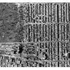
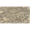
Ce qu'il y a de plus intéressant dans cette carte, c'est de voir comment les noms de rues ont pratiquement tous changer !
Ancienne École Sainte-Cécile
Le parc Victorien-Pesant est situé là où se trouvait la première école Sainte-Cécile
This page have been seen 1185 times.
Historical score:2019
Localisation: Montréal, MTL, YUL, Québec, Canada
* We do our best to get the best accuracy, but in some maps it's hard to go beyond 20m.
Name this place
Add keywords
Add to a list
To find former residents of this place, visit the directory Lovell
Person or institution related
This place has an historical interest?
Historic Ressources
To find out who lived in this house in the last century search in this historic street index.
Lovell Street Index
Discussions
3449 Peel Street was a student Residence run by the Christian Fellowship Association in the 1940's and 50's. I was there from 1947 to 1950.
Cette maison a été construite en 1960 et était la propriété de monsieur Louis Leclerc
Est-ce que Francine Truchon ou sa sœur Monique habite au 2148, rue Dézéry, à Montréal ? Faites-moi savoir à jorgejuansanchez@yahoo.es Merci!


Add a comment or ask a question