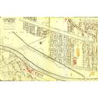
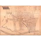
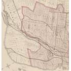
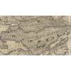
Map details Evaluate precision Bad Ok Good
Map details Evaluate precision Bad Ok Good
Map details Evaluate precision Bad Ok Good
Map details Evaluate precision Bad Ok Good
Édifice Tooke Brothers Limited de Courcelle rue
Building year: 1
City: Montréal
Histograd local id: 1295313
Creation date: 2020-05-05 07:18:57 Modification date: 2024-11-05
631 rue Saint-Philippe
Bonjour , Nous venons de faire l’acquisition de cette maison 631 rue st-phillipe nous aimerions connaître son histoire , l’histoire du quartier étant centenaire nous avons beaucoup de curiosité sur ces détails Pouvez vous nous aider ? Nous diriger ? Merci beaucoup de votre réponse ! Bonne journée!
540-544 rue Thérien
D apres mes recherches, il s avere que le Menuisier qui a construit l Eglise a aussi construit plusieurs des Maisons dans cette rue, possiblewment avec le surplus de Materiaux..en partie..Bien Construit..Structure de Carres de bois de 3 pouces d epais..Mur du milieu en Pruche 4x4 pouces..Ville exigea de moi en 2004-6 apres le Feu..permis emis mais Facade Protegee comme faisant partie d un Ensemble Architectural.
This page have been seen 1685 times.
Historical score:2019
Localisation: Montréal, MTL, YUL, Québec, Canada
* We do our best to get the best accuracy, but in some maps it's hard to go beyond 20m.
Add keywords
Add to a list
To find former residents of this place, visit the directory Lovell
Person or institution related
This place has an historical interest?
Historic Ressources
To find out who lived in this house in the last century search in this historic street index.
Lovell Street Index
Discussions
3449 Peel Street was a student Residence run by the Christian Fellowship Association in the 1940's and 50's. I was there from 1947 to 1950.
Cette maison a été construite en 1960 et était la propriété de monsieur Louis Leclerc
Est-ce que Francine Truchon ou sa sœur Monique habite au 2148, rue Dézéry, à Montréal ? Faites-moi savoir à jorgejuansanchez@yahoo.es Merci!


Add a comment or ask a question