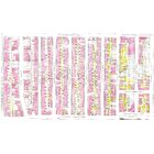
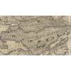
Map details Evaluate precision Bad Ok Good
Map details Evaluate precision Bad Ok Good
Ukrainian Federation 5213 Hutchison rue
City: Montréal
Histograd local id: 1295234
Creation date: 2020-05-03 17:26:07 Modification date: 2025-03-17
Le mystère de l'avenue du Parc
Connaissez-vous la raison historique derrière la courbe dans l'avenue du Parc à cet endroit entre Fairmount et Saint-Viateur?
Parc Saint-Michel Rue Saint-Dominique
Le Parc Saint-Michel a été aménager en partie sur un terrain autrefois occupé par les ateliers de l'Institut des Sourds et Muets localisés sur la rue Laurier de l'autre coté de la rue.
5702-5704 rue Waverly
Qui habitait là en 1944 ?
5702-5704 rue Waverly
Selon l'annuaire Lovell de 1944, les habitants de se plex étaient 5702, Lucien Beauchemin, 5704, I. Michaud.
5278-5282 Saint-Urbain rue
5278 st. Urbain i
5156-5160 avenue Casgrain
I grew up on Casgrain St and lived at 5158A. I was 5 yrs old in 1949 when this aerial photo was taken. All the homes on that street had sheds in the back to store coal in the winter. Coal was used until the stoves were converted to oil probably some time in the late 30s. In back of the house is a laneway - we called it "Lucky Lane". A park with a baseball diamond was in back of Casgrain St and is still there. There was a skating rink put up in the winter and a nice chalet to warm up from the cold. There was a swing set, slide and monkey bars at the South end of the park. Kids were always playing outside until dark. Nice street to grow up. Still live in Montreal and have been back to visit the neighbourhood several times.
5702-5704 rue Waverly
EN 1944 ,ce n'est pas I Michaud, mais M. Omar Michad, sa femme Éva et ses enfants ; Gaétane,moi Arlette et Paul-André qui habitait au 5704 Waverley,
58 avenue Elmwood
58 Elmwood Construction 1925
This page have been seen 1634 times.
Historical score:0
Localisation: Montréal, MTL, YUL, Québec, Canada
* We do our best to get the best accuracy, but in some maps it's hard to go beyond 20m.
Add keywords
Add a construction year
Add to a list
To find former residents of this place, visit the directory Lovell
Person or institution related
This place has an historical interest?
Historic Ressources
To find out who lived in this house in the last century search in this historic street index.
Lovell Street Index
Discussions
Within this platform, find an extensive selection virtual gambling platforms. Whether you’re looking for classic games or modern slots, there’s something for every player. The listed platforms...
The Aviator Game combines exploration with big wins. Jump into the cockpit and try your luck through aerial challenges for huge multipliers. With its retro-inspired visuals, the game captures the ...
本站 提供 多样的 成人内容,满足 各类人群 的 兴趣。 无论您喜欢 哪种类型 的 内容,这里都 应有尽有。 所有 资源 都经过 专业整理,确保 高品质...
这个网站 提供 多样的 成人资源,满足 各类人群 的 兴趣。 无论您喜欢 什么样的 的 内容,这里都 种类齐全。 所有 内容 都经过 严格审核,确保 高...
这个网站 提供 海量的 成人资源,满足 不同用户 的 需求。 无论您喜欢 哪种类型 的 视频,这里都 应有尽有。 所有 材料 都经过 精心筛选,确保 高...


Add a comment or ask a question