Map details Evaluate precision Bad Ok Good
Map details Evaluate precision Bad Ok Good
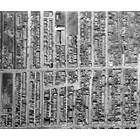
7055-7057 Sagard rue
Building year: 1
Arrondissement: - Villeray–Saint-Michel–Parc-Extension
City: Montréal
Floor height (above ground): 2
Building usage: Logement
Histograd local id: 1147541
Creation date: 2020-04-28 13:24:37 Modification date: 2024-11-05
J’aimerais vois la maison de 1931 la construction 2154 2156 rue Augier Rosemont petit patrie
2152-2156 rue Augier
Esque ces possibles de revoir la maison en 1931 je demeure 2156 2154 rue augier je recherche la photo de la maison nous avons restauré l’intérieur complet j’aimerais pouvoir voir la maison courriel jpcharette@live.ca
This page have been seen 1209 times.
Historical score:2019
Localisation: Montréal, MTL, YUL, Québec, Canada
* We do our best to get the best accuracy, but in some maps it's hard to go beyond 20m.
Name this place
Add keywords
Add to a list
To find former residents of this place, visit the directory Lovell
Person or institution related
This place has an historical interest?
Historic Ressources
To find out who lived in this house in the last century search in this historic street index.
Lovell Street Index
Discussions
3449 Peel Street was a student Residence run by the Christian Fellowship Association in the 1940's and 50's. I was there from 1947 to 1950.
Cette maison a été construite en 1960 et était la propriété de monsieur Louis Leclerc
Est-ce que Francine Truchon ou sa sœur Monique habite au 2148, rue Dézéry, à Montréal ? Faites-moi savoir à jorgejuansanchez@yahoo.es Merci!


Add a comment or ask a question